Northern Norway – 1 to 17 June 2022

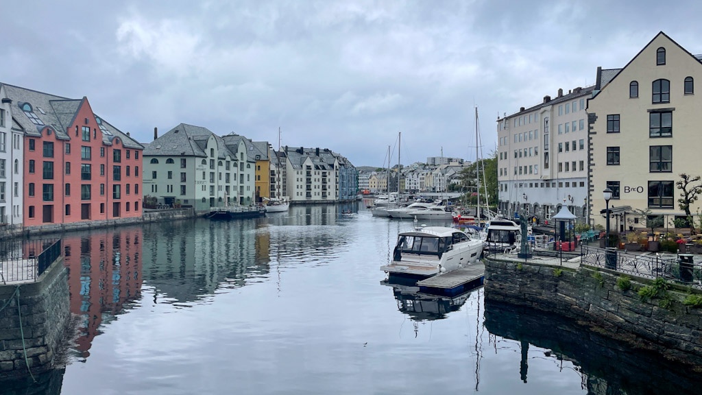
We left the campsite near Trondheim and hit the E6 north towards the Arctic Circle. We’d bought forward all our plans by a couple of days and changed our mind on using the coastal road, as a bridge further north on the E6 had been damaged essentially cutting off the north unless you took a 600km+ diversion via Sweden and Finland. We’d been told it would be a quick fix given the importance of the road (it runs all the way through the country from the Swedish border in the south to the Russian border in the far north east) but we had still had lots to do and see before meeting friends at the end of the month so didn’t want to risk any delay.

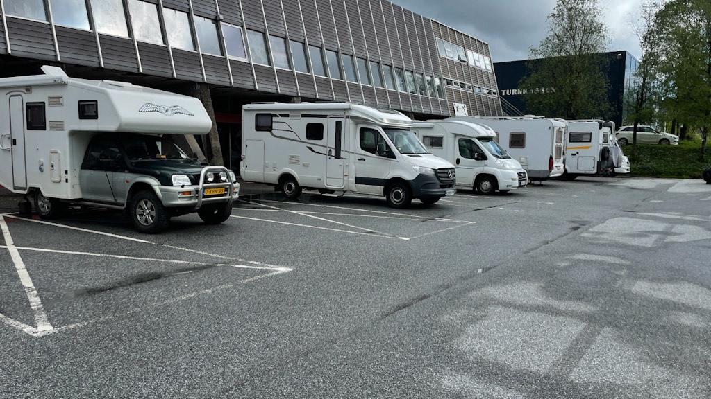
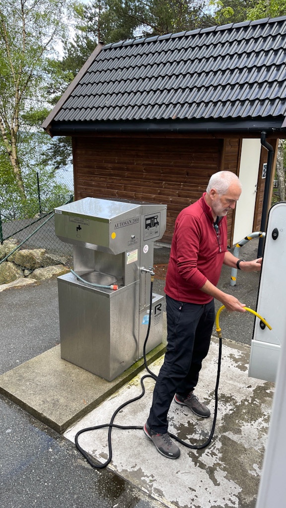
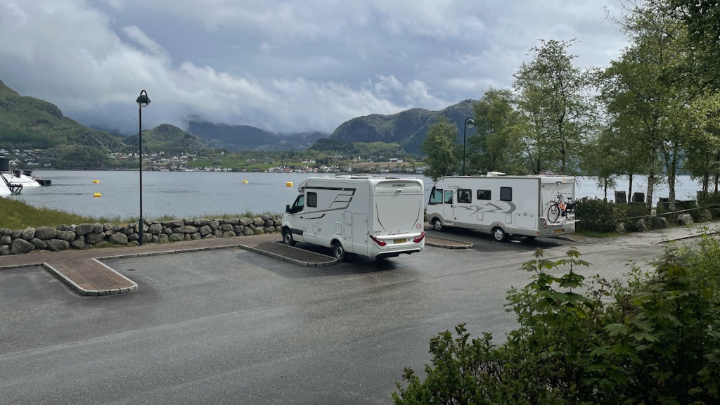
Most of this part of the trip was staying on free spots found on Park4night but we did use a couple of paid parking areas on the Lofotens (more on those later!). As we mentioned before motorhoming here is so easy with plenty of places to stop overnight and accessible, free service points.

The Arctic Circle

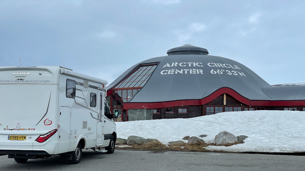
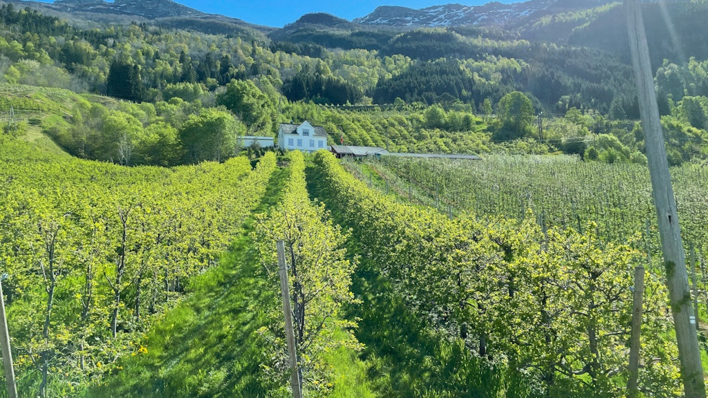
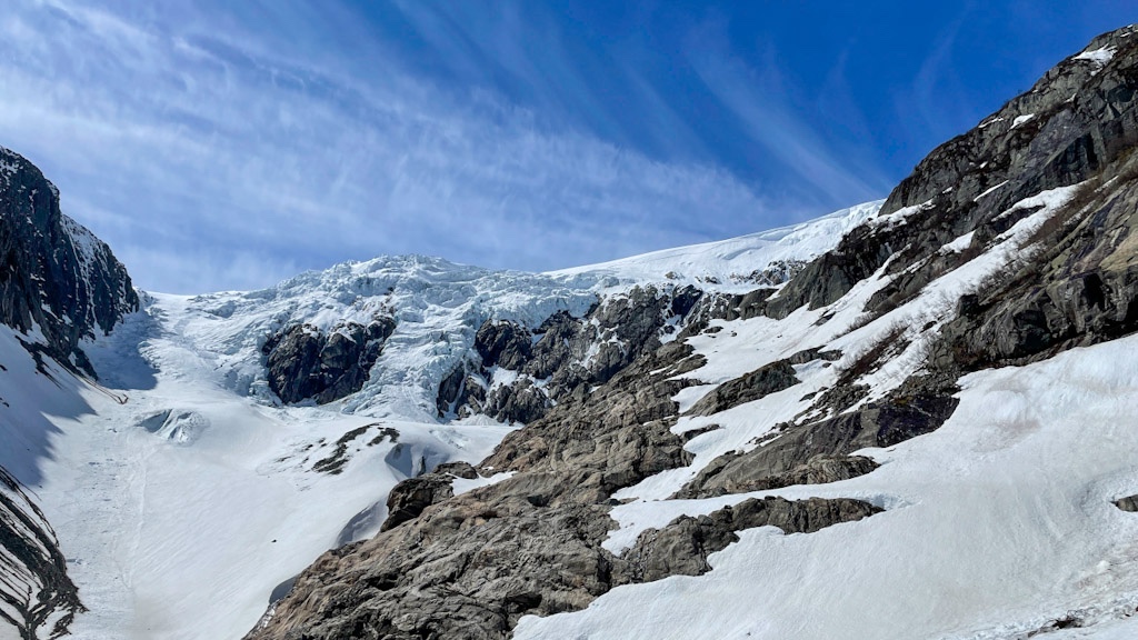
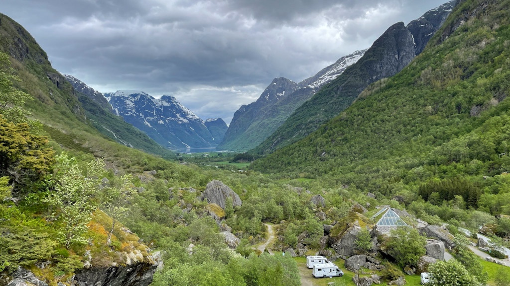
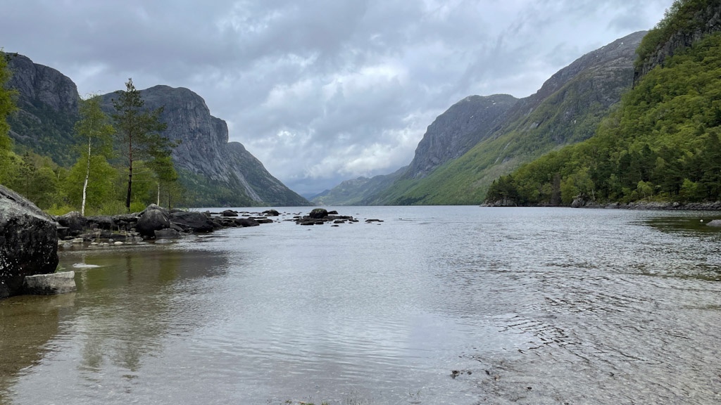
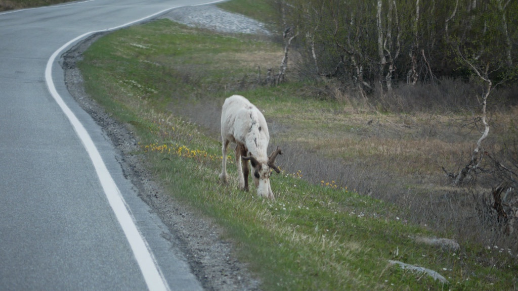
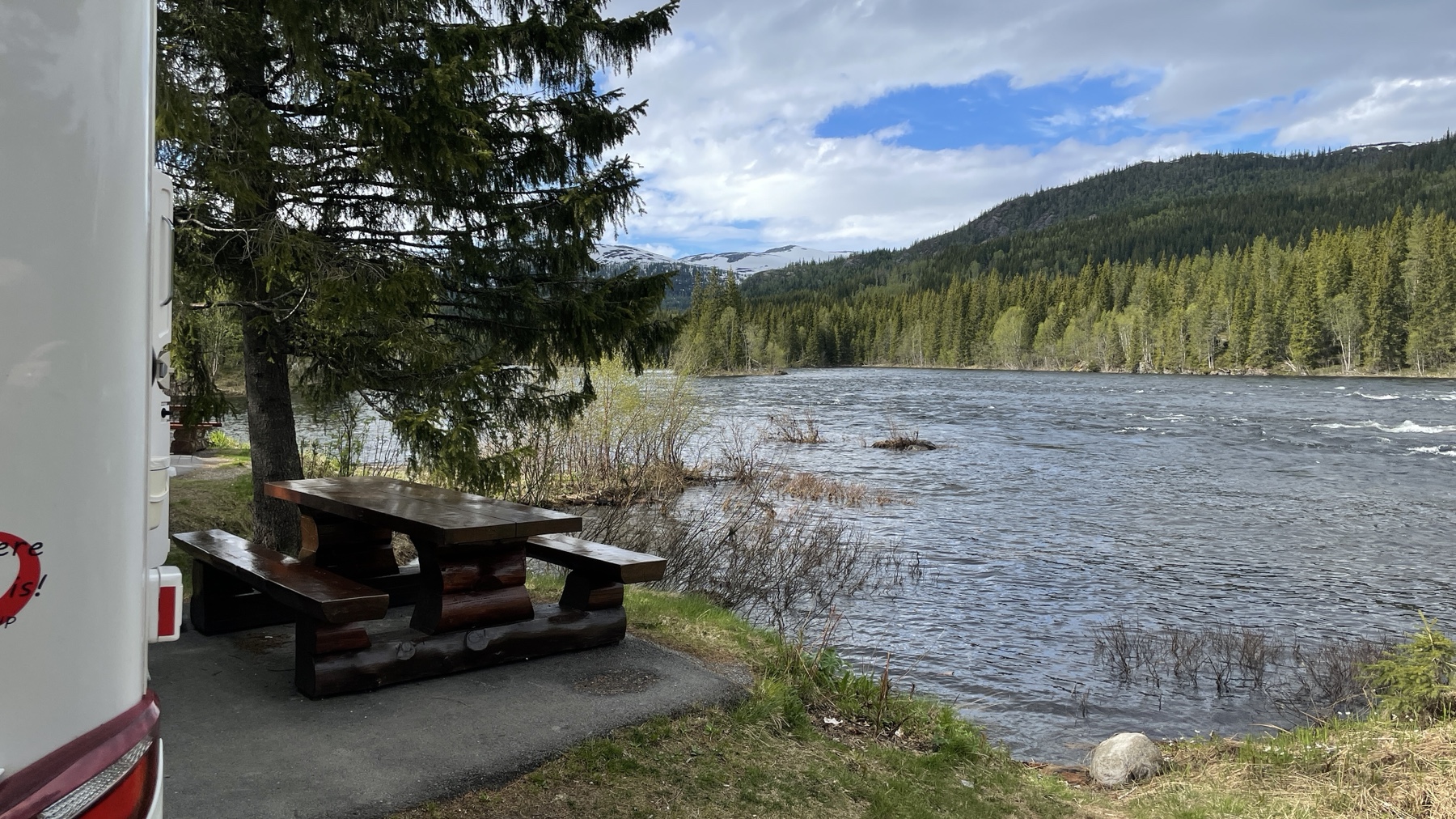
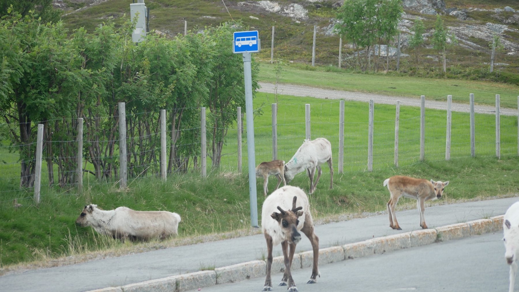
We slowly moved from the rivers and mountains of central Norway to the flat snow covered plateau at the Arctic Circle, encountering our first roadside reindeer of the trip!

The Arctic Circle visitors centre is mostly a souvenir shop and cafe but there are a couple of war memorials on the edge of the car park. You can stay there overnight and we were close enough to be able to use the Wi-Fi so took the opportunity to update apps and back up the phones 狼.

Saltstraumen

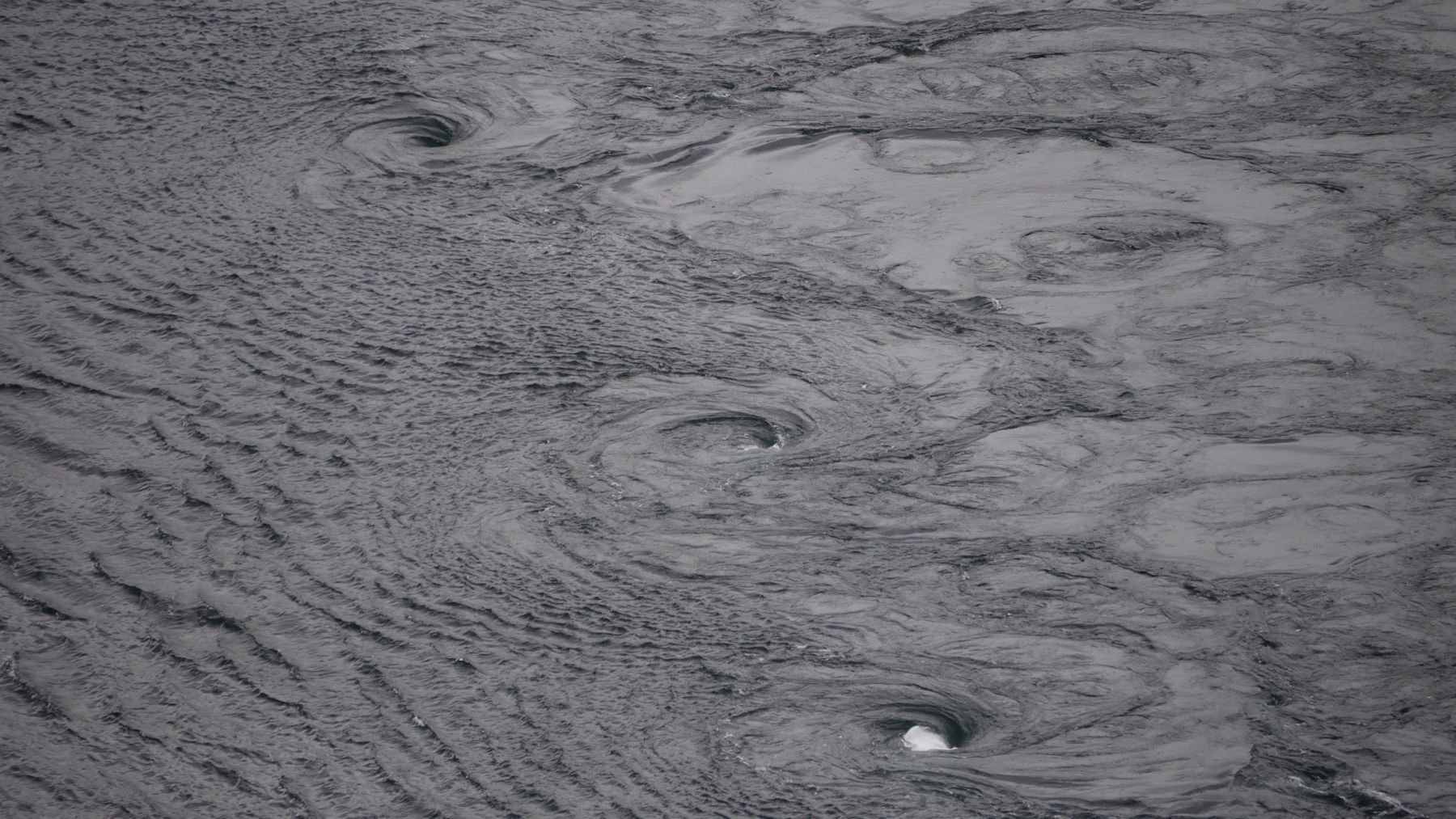
Our next stop was Bodo to take the ferry to the Lofotens. On the way we visited the Saltstraumen, one of the world’s strongest tidal-current maelstroms. The area has huge tidal variations and four times a day large amounts of water are pushed through a narrow gap to produce the eddy. This was not something to go out of your way too see but we were in the area and had timed it right for a high tide so thought why not.

A free riverside park up for the night near Namsen

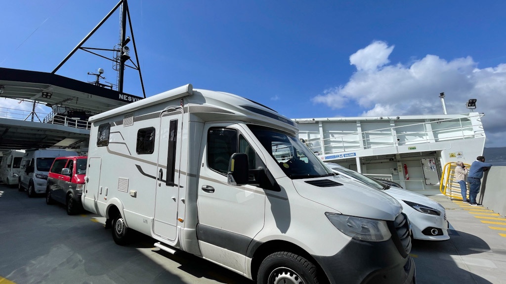
We took the 3 hour 15 min ferry from Bodo to Moskenes. We were slightly delayed in leaving due to weather but as there had been a gale warning earlier in the day, we were thankful for a calmer crossing. If you have a ferry pass you can get the crossing for almost half price (full price was approx £175) but the toll/ferry tag we had didn’t cover this ferry and you can’t get the pass once in country as it’s sent to your home address.

Gammelgarden Bakery

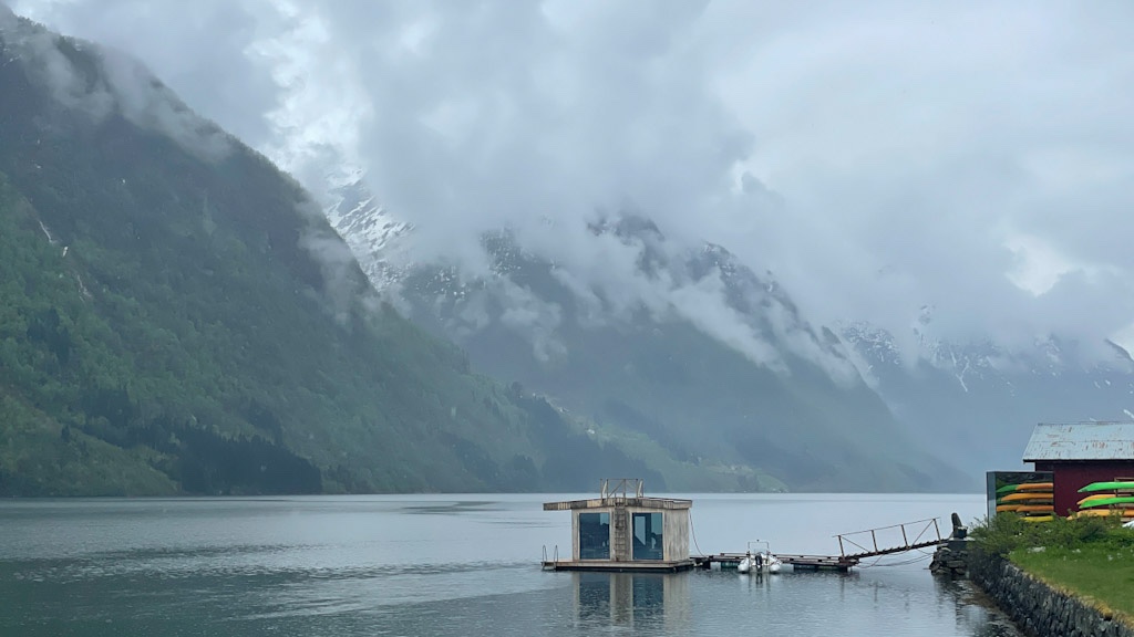
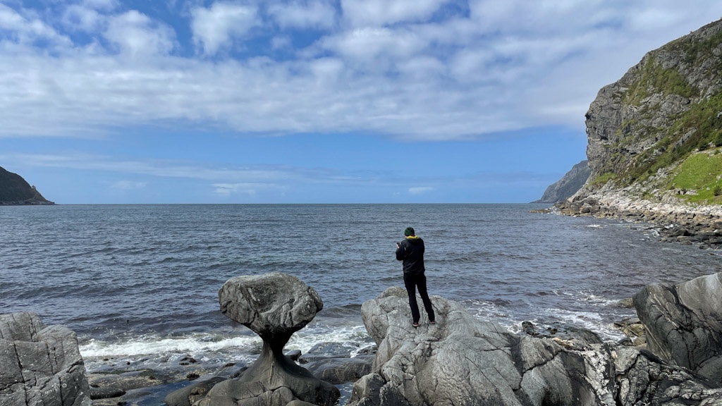
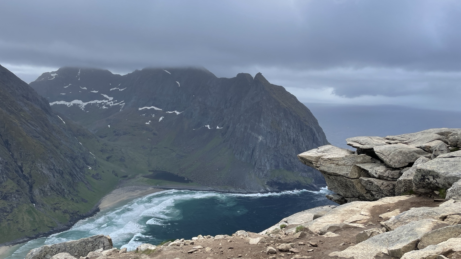
The Lofoten Islands are quite simply stunning! Sharp, high peaks against fjords and the sea, hidden beaches and an abundance of the typical Norwegian fishing villages as seen in guidebooks.

Beautiful Å

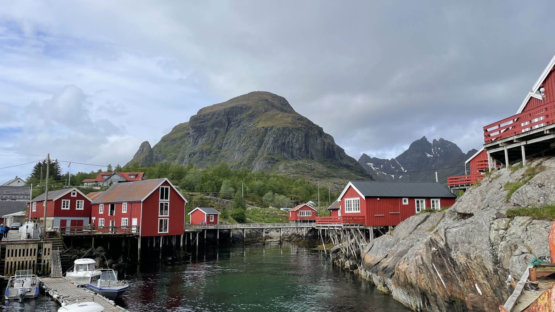
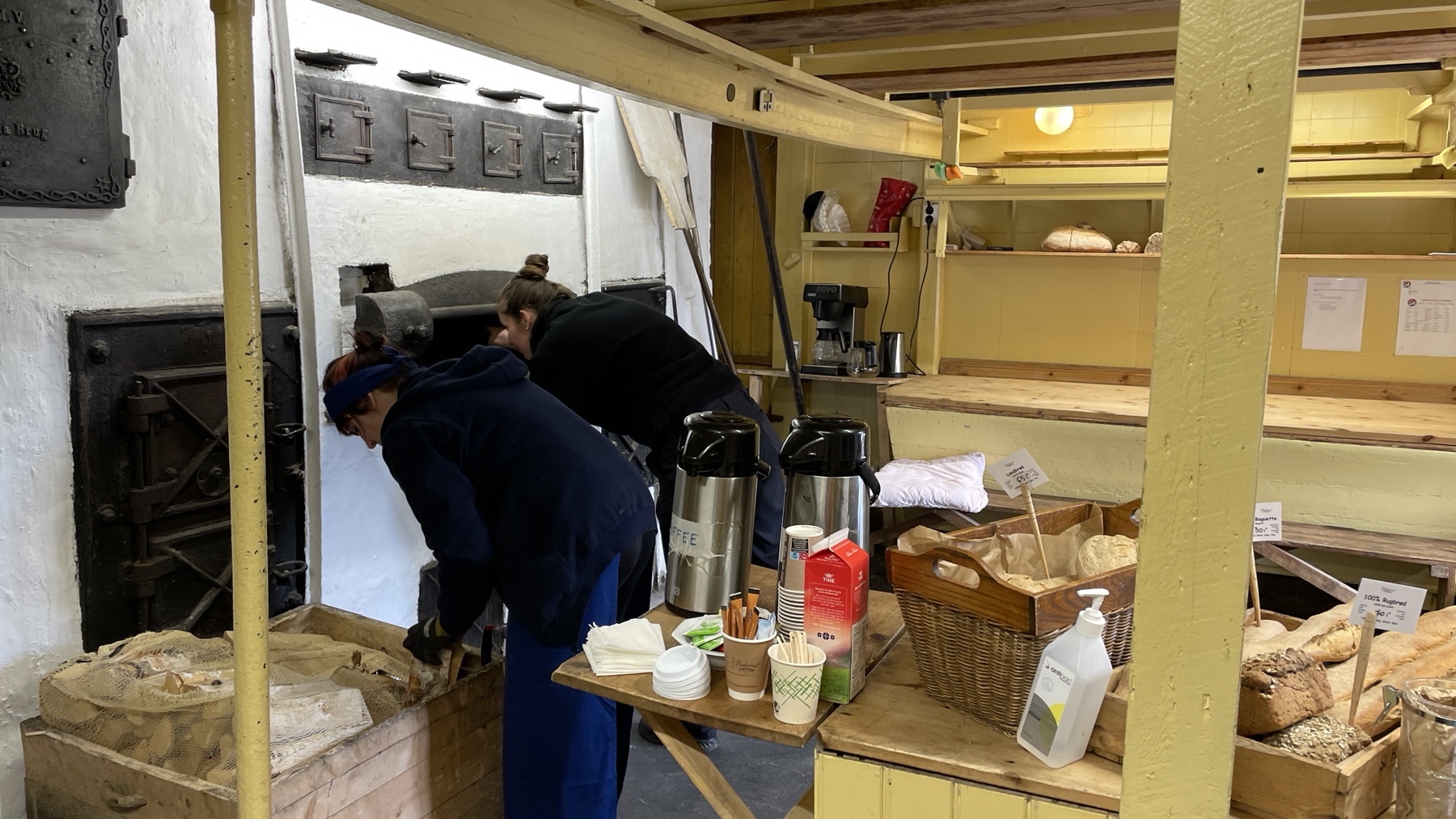
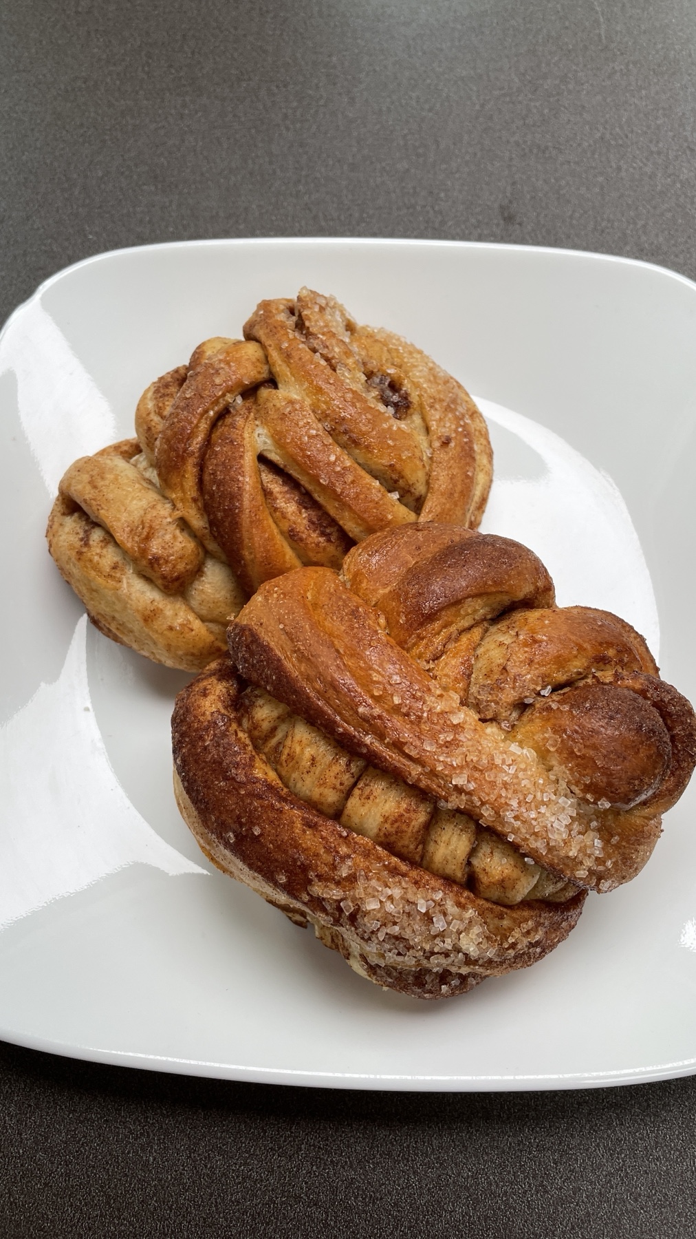
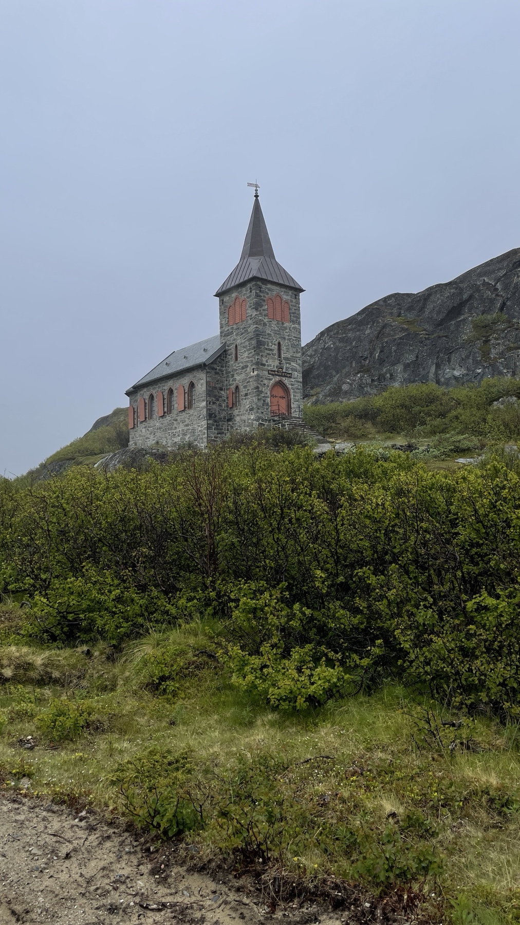
On arrival we drove the short distance to the village of A, the starting point of the E10 which runs the length of the islands back to the mainland just north of Narvik. The Gammelgarden Bakery is well worth a visit for its cinnamon buns which are baked in a vintage oven.

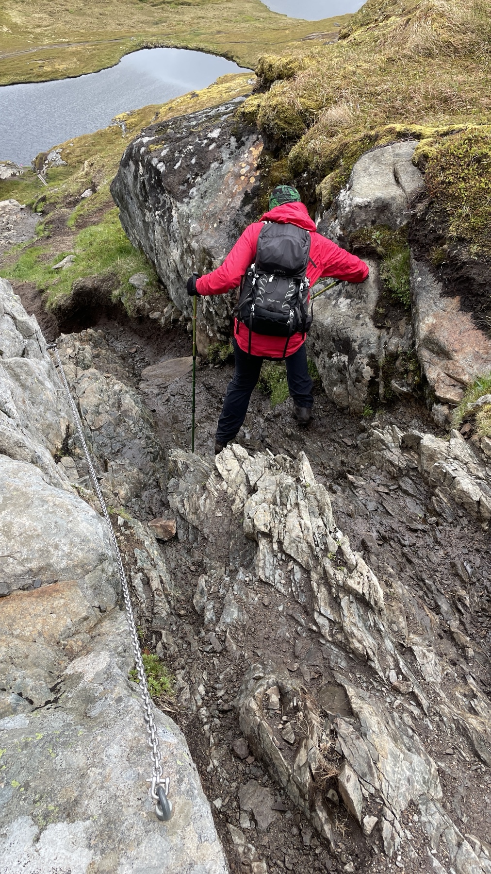
We followed the E10 through the two islands of Moskenesoya and Flakstadoya, spending two nights near Fredang, from where we hiked up the headland to see the beach at Ryten. The “campsite” is nothing more than a grass field but has toilets and a shower, is close to the beach and the hiking path. The cost was NOK100 per night (about £8) which was the same price for day parking.

If a hike has a chain you know it will be a good one.
The view from Ryten was well worth the hike.

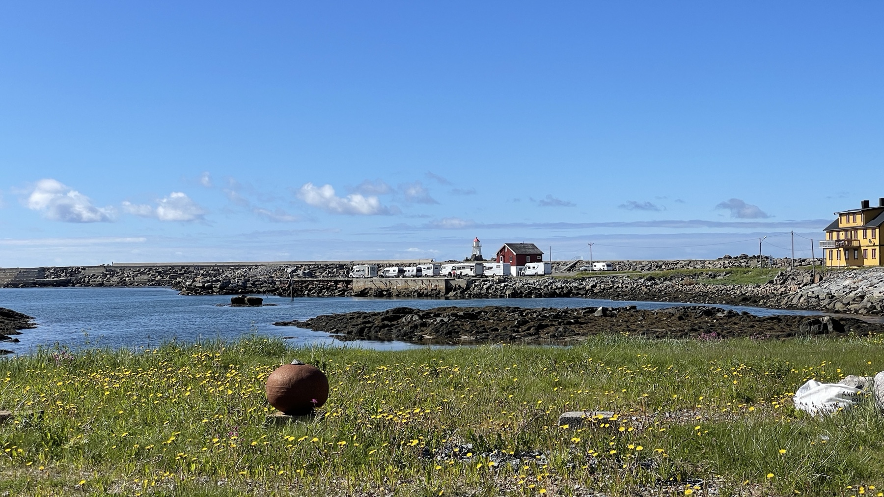
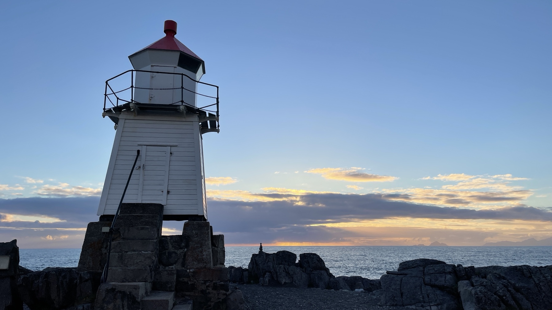
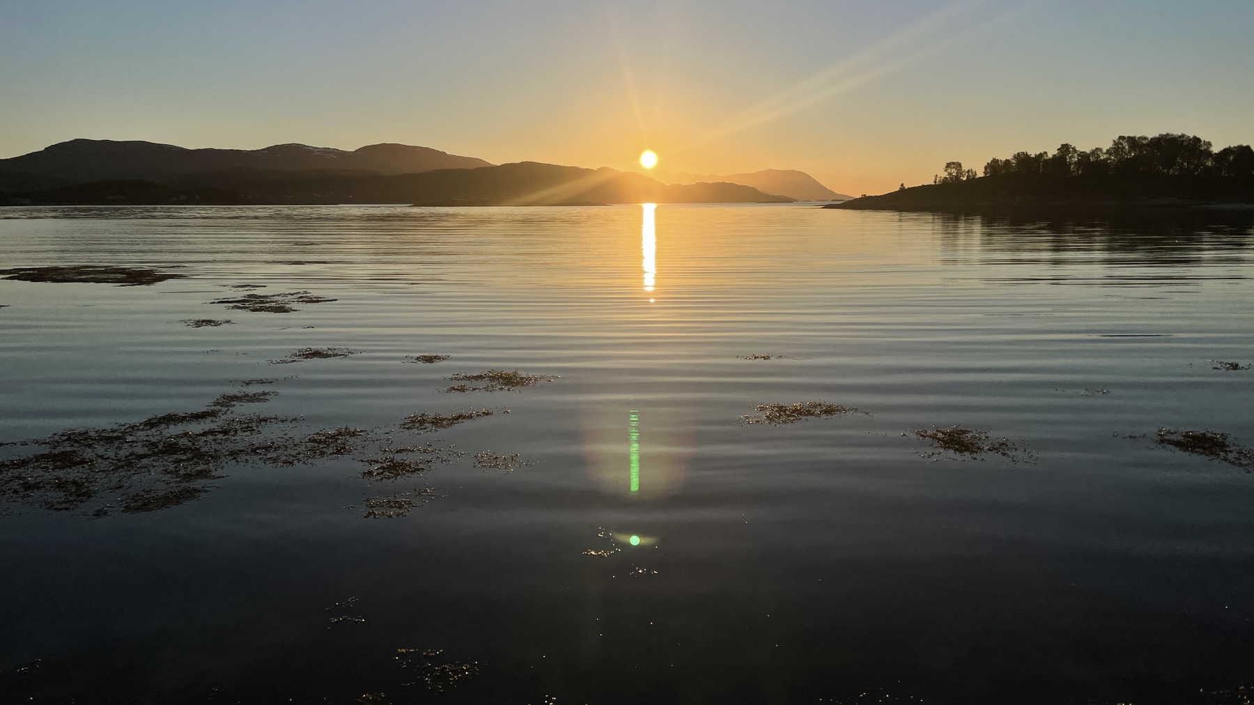
We took a detour off the E10 to the village of Laukvik where we stayed in the village aire. It’s a large quayside concrete car park but EHU is available and it has a building with showers, toilets and free, yes free, laundry facilities. It was NOK200 per night or NOK250 with EHU and one of the locals comes round to collect the money (cash or card). There’s a great little cafe in the village and a coffee roasting business, although the latter was closed when we visited and it was here that we got our first glimpse of the midnight sun. The lack of darkness is playing a little havoc with our internal clocks and we find ourselves going to bed later than usual but the blinds do a pretty good job at keeping the van dark.

Laukvik
Laukvik
Kafe Naust in Laukvik

Our last night on the Lofotens was in a remote park up near Fauskevag, south of Harstad, where we really got to see the midnight sun.

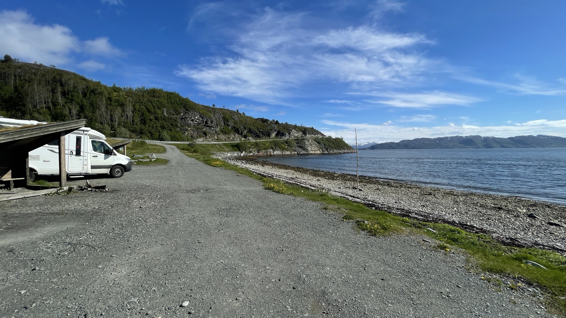
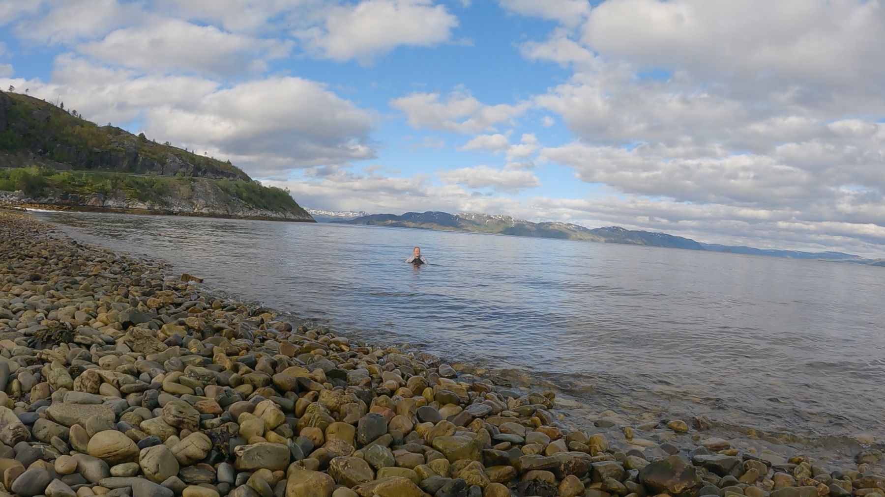
From here it was back on to the E6 on our way to Nordkapp. We found another amazing park up near Talvik where June got to dip in the sea, and yes we are still above the Arctic Circle.

A great park up near Talvik
June swimming at Talvik
Orcas at Talvik

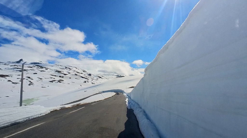
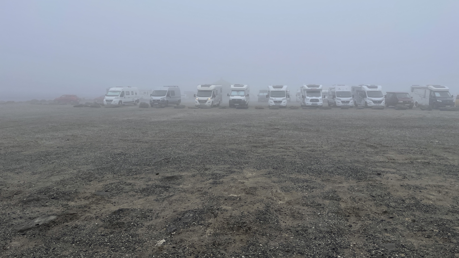
The next stop was the most northerly point of Norway that you can drive to at Nordkapp. The E69 is a long windy road that takes from Olderfjord to Nordkapp, via coastal cliffs, open plateaus, deep tunnels (the Nordkapptunnel reaches a depth of 212m below sea level) and sees a never ending flow of motorhomes, motorcycles and a surprising number of people on good old fashioned pushbikes!

Nordkapp

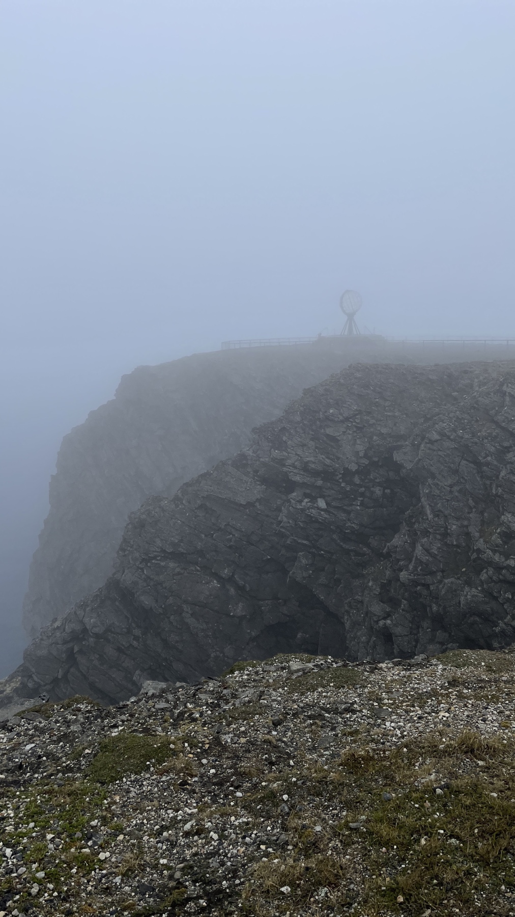
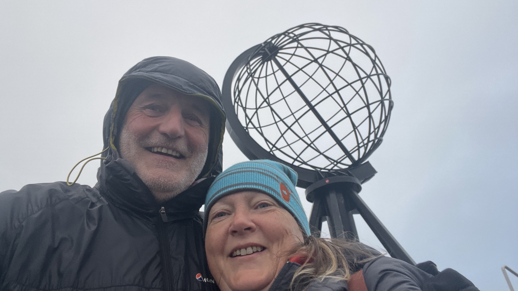
At the end of the road is the visitor centre where parking is free but you are supposed to pay NOK310 (£25) each to enter, even just to go to the cafe and souvenir shop. We had the misfortune to arrive at the same time as coach loads of visitors from a cruise ship that we had passed moored in the nearby town of Honningsvag. On the upside this meant we could sneak into the centre with the masses unnoticed, grab our sticker and use the Wi-Fi unnoticed! The coaches just kept coming with the last one leaving around midnight but the place was empty in the morning meaning we could take our photos uninterrupted.

Just a few Motorhomes at Nordkapp

We took a slight detour on the way back via Hammerfest just because June liked the name! We found it difficult to park in the centre due to roadworks and the fact that the cruise ship was now here, so no visit to the Isbjornklubben, aka the Royal and Ancient Polar Bear Society where you can become a lifetime member for a small fee. For an additional fee you can enjoy the dubious experience of being “knighted” with the penis bone of a walrus! Apparently it’s all very tongue in cheek. We did manage to park briefly by the Struve Geodetic Arc, one of a series of points stretching from here to the Black Sea in Hungary built as part of an experiment in the early 19th century to measure the shape and size of the Earth and determine the flattening of the planet at the poles.

Very well behaved Reindeer at Hammerfest waiting for the bus

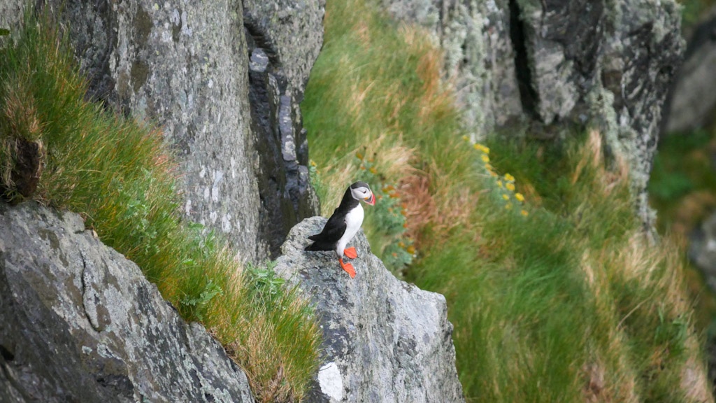
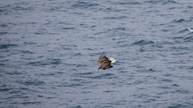
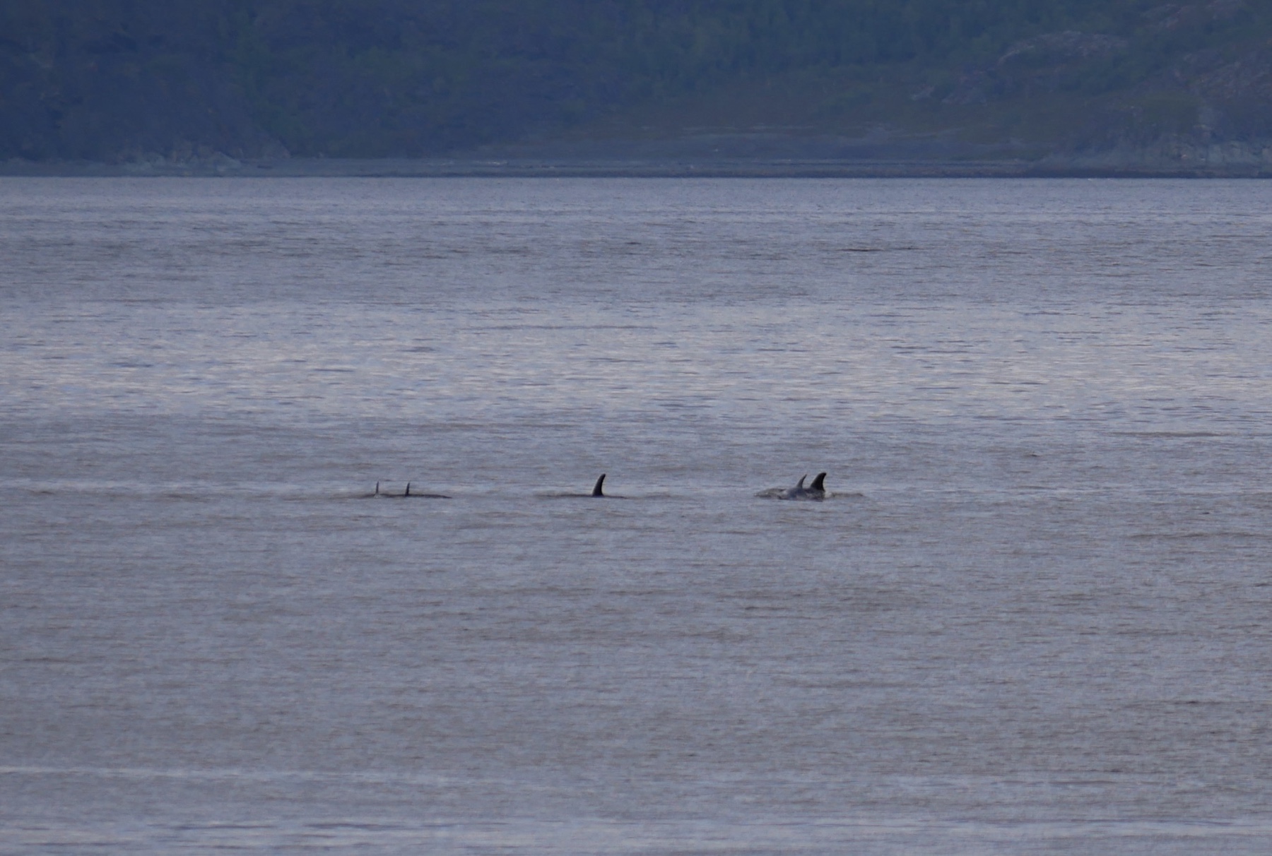
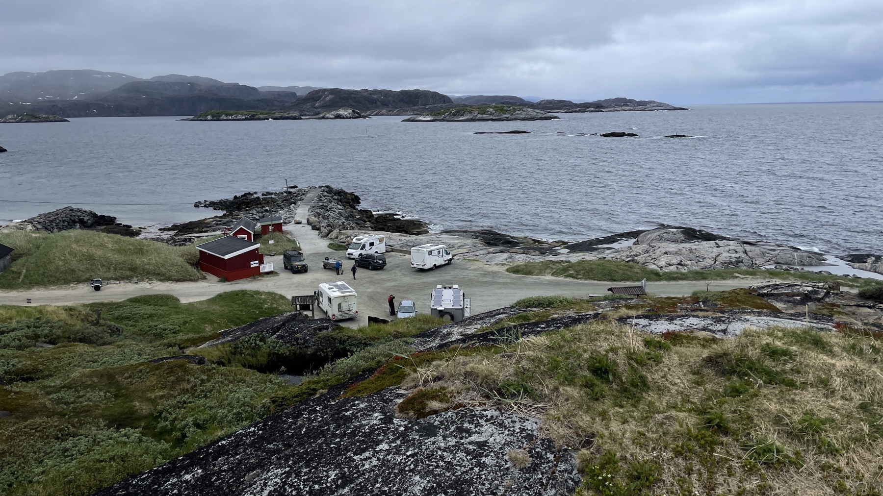
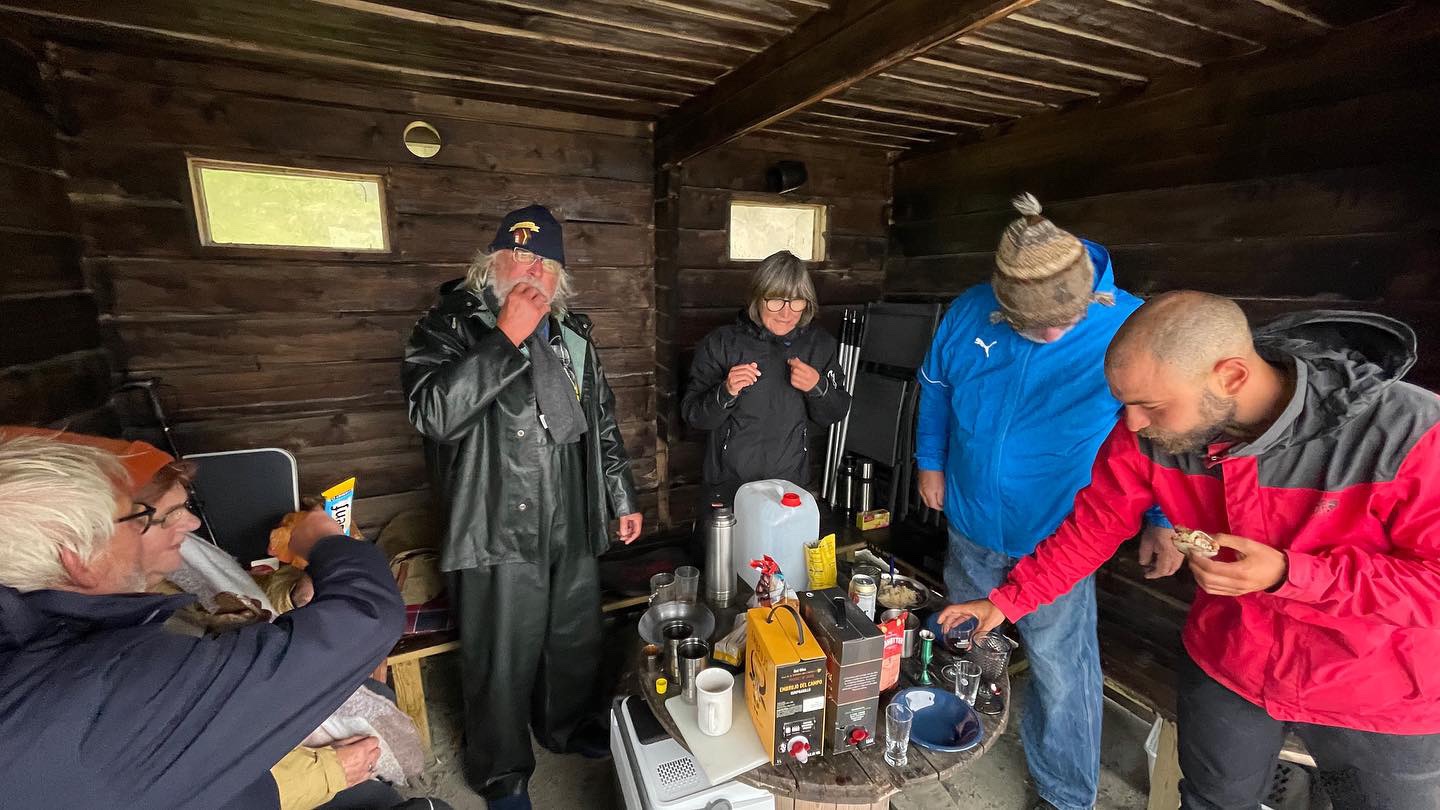
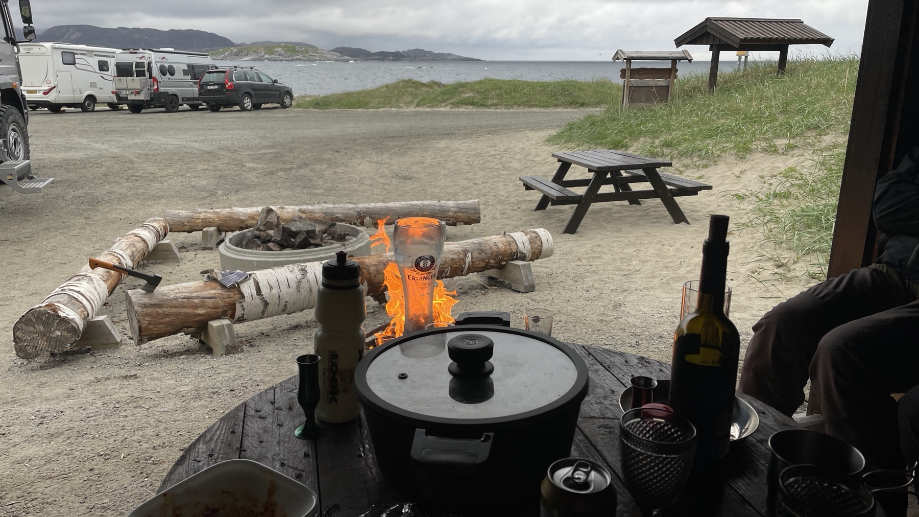
These few days were mostly driving and from Hammerfest we headed across the north eastern region of Norway, as far as we could go to the Russian border. We spent a couple of nights at Grense Jakobselv on the Barents Sea, well worth the 50km of bumping down a road which in some places was tarmac but other places gravel and potholes. This was just another site we found on Park4night and there were a few other vans there, plus on both nights two different cyclists with tents. The site has toilets, a hut and fire pit with a ready supply of chopped wood and we spent the evenings chatting and drinking round the fire. We didn’t always understand each other – we were a mix of German, French and us Brits, but we understood enough. The Norwegian army patrol the area regularly but despite the guns, were very friendly and chatty. Sadly we didn’t get to see whales which are often seen in the area but we had seen some dolphins on our way here.

Park up at Grense Jakobselv
Coming together of nations. Two Brits, a Frenchman who had cycled over 6000 kms, 6 Germans and a dog
There were free logs for the fire provided in the shelter.
The Church at Grense Jakobselv

That’s the end of this part of the trip as we are now in Finland for a few days. We are making our way back to Norway to meet friends for a week’s holiday in a house on a fjord near Tromso and from there we start making our way back to the UK via a few weeks in Sweden.

West Norway, Lysefjord to Trondheim – 15 May to 1 June 2022

After leaving southern Norway, we headed north and west into the western fjords surrounding Bergen. We followed Route 13 for most of the way with a couple of side trips.

This has to be one of the most picturesque roads we have ever driven (well until we got to routes 7 and 55…!) taken us alongside fjords, over fjords on ferries, through tunnels under and roads over mountains. To top the physical scenery, the area around Sorfjorden is known for apple production and the trees were in full spring bloom.

Always good to be first on the grid.

May 17th is a national holiday celebrating Constitution Day with most houses flying the Norwegian and we passed through several towns/villages having parades with people in national dress. We were able to stop for one parade and it was great to see what seemed like the whole village taking part.

Celebrating Constitution Day

One of the diversions we took off 13 was to the Folgefonna glacier. After a walk through the forest and a scramble over rocks (using ropes in places) we made it to the viewpoint at the base of the glacier. For the more adventurous it is possible to hire a guide and continue to the glacier but getting to the viewpoint was enough for us!

When it got tough there were ropes and chains to help you to the viewing point for the Folgefonna glacier.
The Folgefonna glacier.

Waterfalls are everywhere and not just little pretty streams – with spring arriving the snow is melting and the force of the water in the falls and rivers is phenomenal.

Voringsfossen

Another road worth a mention is the 7 which we followed on to the Hardangervidda Plateau, Europe’s largest mountain plateau and snow covered when we were there, where we visited Voringsfossen and stayed at the Sysenvatn Dam.

The sunsets are stunning. This was at the park up by the Sysenvatn Dam

We paid a brief visit to Bergen, Norway’s second largest city, taking the tram from our glamorous car park next to an ice hockey rink – NOK300 for 24 hours parking but services and EHU available. The tram was NOK40 per person each way direct into the centre. The city centre was fairly quiet despite several cruise ships being in port but after a walk around the old town and harbour we headed out to the next equally glamorous overnight spot in an IKEA car park!

Bergenhus Fortress, Bergen
Park up next to the hockey stadium Bergen
Well we had to really.

We continued north on the 13 and took another detour to the town of Fjaerland (or Mundal) which is known as Norway’s book town. We parked up on the old fjord side quay surrounded by places selling books; old cow sheds, a telephone box, a former toll booth and some conventional shops! Fjaerland is a small one street town but we found a quirky coffee shop (of course!),there are walks from the town, an outdoor activities centre and you can even rent the town sauna which floats on the fjord.

Fjaerland (or Mundal) which is known as Norway’s book town.
Cafe in Fjaerland (or Mundal)
Sauna on the end of a pontoon in Fjaerland

Our next overnight stay was just outside Lom which we reached after driving another stunning road, the 55. On our way to Lom we had lunch at the highest point, 4,700ft above sea level, surrounded by banks of snow which were higher than the van in places!

The 55 Road.

Lom has a beautiful stave church, built from wood and originally dating back to 1200.

Lom has a beautiful stave church

We were then hoping to visit Geirangerfjord and drive along the hairpin bends of Trollstigen but the roads hadn’t yet reopened after the winter so we headed towards the coast to see a couple of places in the hope that the situation would change.

Melkevoll Campsite

We headed to the inner Nordfjord and Melkevoll Campsite in Jostedalsbreen National Park at the foot of the Briksdalsbreen Glacier. After a couple of rainy days we took the footpath up to the glacier which is a walking geology lesson, so right up our street! We were also lucky to pick one of the bright, sunny days to walk and spent a while sitting by the lake at the base of the glacier.

The waterfall behind Melkevoll Campsite.
Briksdalsbreen Glacier

Melkevoll Campsite is a mixture of open pitches and lodges surrounded by mountains and waterfalls. The cost was NOK280 p/n with no EHU and laundry an additional NOK20 per wash/dry. Machines are coin operated and reception will give you the change. The site also has a sauna and a small plunge pool in the river, if you’re brave enough!

Norway certainly has some amazing waterfalls

A chance conversation in a car park a few days ago, took us to the island of Maloy to see Norway’s “most photographed stone”! Definitely an interesting piece of geology but we have to confess to being slightly underwhelmed…….

The rock was slightly smaller than we expect

That same conversation also led us to the island of Runde, known as a good bird watching location. We hiked up to the island’s north shore and across the plateau to find the puffins which nest on the cliff side at this time of year. We sat for a while watching the puffins coming and going but also spottted gannets, razorbills, skuas and white tailed eagles.

Puffins, once we had found the correct cliff.
White tailed eagle.

We stopped briefly in Alesund for a wander around the town. It was a Sunday so most places were closed but we did find a fish and chip kiosk open and the familiar smell drew us in!

Alesund

One of the most well known roads in Norway is the Atlantic Highway, a stretch of road linking several small islands north of Alesund. We did miss part of it but drove the 8km section from Vevang which you see in the photographs. There are several pull offs along the road big enough for motorhomes where you can stop to take photographs and one of them has an information centre, a cafe, toilets and a small walk way around one side of the island.

Our final stop in this region was another campsite just south of Trondheim as again it was raining. We stayed a couple of nights at Hogkjolen Fjellcamp (NOK155 p/n no EHU) which has a lot of fixed pitches and some areas for tourers. First impressions were of a site that needed some tidying up but they were deceptive! We camped down by the trees and the services were clean and tidy. Great hosts too, which is how we’ve found all the campsites so far.

From here we head a north, a long way north!

Southern Norway, Kristiansand to Lysefjord – 8 to 15 May 2022

After a mad rush through five countries we made it to Norway, the main destination for this trip. We took the ferry from Hirtshals in northern Denmark to Kristiansand on a bright day and parked up for the night just to the west of the city.

Coming into Kristiansand

Day one’s task was to find a replacement tyre as Bob had noticed a noise coming from one of the front tyres as we were speeding through Germany. After trying several places we were pointed in the direction of a tyre specialist near Stavanger where we ended up having to buy two to keep a pair on the front. Not cheap but we decided to bite the bullet and get them done so the issue of not having a spare wouldn’t be a constant niggle at the back of our minds.

One of the many tunnels in Norway

The dash from Kristiansand to Stavanger meant we didn’t see much of the south coast but as we’re discovering there is SO much to see in Norway, if we’d spent more time here then we would have had to cut back somewhere else.

Motorhome facilities are fantastic here in Norway. These are in a lot of lay-bys.

Before leaving the UK we had ordered a BroBizz tag which would allow tolls and ferry costs to be charged direct to our UK credit card (have Halifax Clarity Card so no conversion fees). In hindsight we should perhaps have also ordered a Norway ferry pass/tag which would have cut the cost of the ferries in the north of the country and to the Lofoten Islands. Unfortunately this couldn’t be done on the road as the tag is delivered to your home address. Without a tag, tolls and ferry charges are invoiced to your home address – everything is done via ANPR.

One of the many free park overs we have used.

As a general comment, motorhoming in Norway is a breeze! There are lots of free parking spaces in amazing locations (where you can’t park is clearly marked) and there are roadside standalone service points everywhere – we are using Park4Night as our source for both. Park ups have been clean and no-one seems to abuse the facilities or overstay. All probably why we are seeing hundreds of vans on the road!

The view from Randerburg “Mountain”

After a night on top of Randerburg “Mountain” (we were about 100ft above sea level!), we left Stavanger via the 14.4km long Ryfylketunnelen under the sea/fjord to spend a couple of free nights in a car park on the edge of Lysefjord near Oanes. The weather is very unpredictable and when the weather forecast has been for a few days of rain we have headed for campsites to catch up on laundry and use their wifi.

A bit too damp to use outside seating at the Oanes aire.

Since the UK phone companies are all reverting to capping EU roaming allowances or charging for usage we are trying to be mindful of our data usage as we typically use huge amounts of data. We have looked into getting a local SIM but they have proved to be expensive and topping up would be difficult outside Norway (thinking ahead to Finland and Sweden). So we’re hoping that we can eke out our UK allowances until friends come out at the end of June and bring us a few new SIM cards!

Wathne Camping

Wathne Camping is a mix of lodges and camping with a couple of pitches on a small beach next to a fjord but after parking there for the afternoon watching the water rise, we retreated to a grass pitch in the centre of the site. As luck would have it, a raised waterside pitch with a deck became available the following morning so we snuck back down there again! The cost here was NOK300 (approx £25) per night including EHU with laundry facilities at NOK35 (£3) per wash/dry and operated on an honesty system – you tell reception how many times you used each machine.

June on the edge of Pulpit Walk

Having caught up with ourselves, and with the rain stopping briefly, we managed one of the walks on the list of must things to do in Norway – the hike up to Preikestolen or Pulpit Walk. This also coincided with our wedding anniversary and we couldn’t have had a better day!